


Geoweb is a small consulting company with a rich experience of working on GIS related projects. Some of projects that we have worked on include:
We have specialities and interests in OGC standards, INSPIRE, SDI (Spatial Data Infrastructure), LADM (Land Administration Domain Model), spatial databases and spatial data in general.
We use various programming languages/libraries such as Python, JavaScript, HTML/CSS, Angular, React, OpenLayers, Leaflet.
Also, we have experience with the following geospatial applications: GeoServer, QGIS, PostgreSQL+PostGIS, GDAL/OGR, FME, AutoCAD.

Client: Federal Geodetic Administration
Description: Development of ETL procedures for harmonization of spatial data of SDI FBiH with INSPIRE directive, Federal Geodetic Administration BiH, 2018.
Duration: 2019
Client: State Geodetic Administration
Description: Consulting services for data harmonization of the Basic Topographic Database (TTB) and Spatial Units Registry (RPJ) data according to INSPIRE data requirements and specifications, State Geodetic Administration, 2018.
Duration: 2018
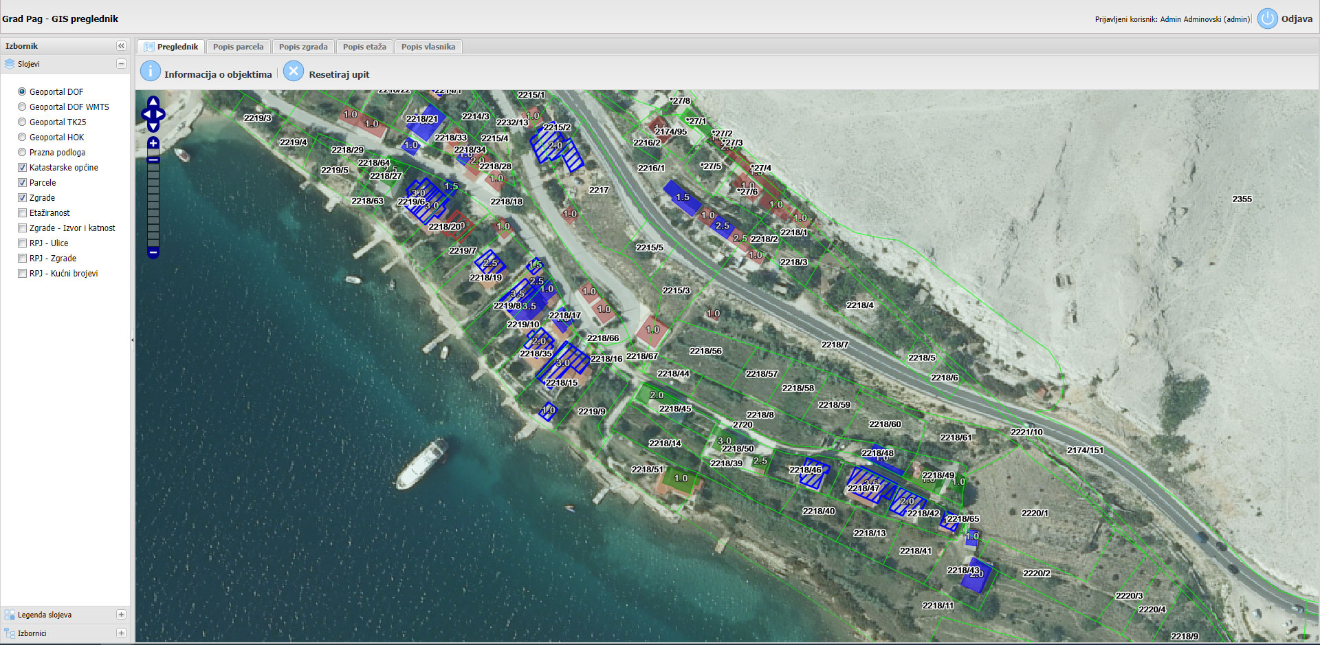
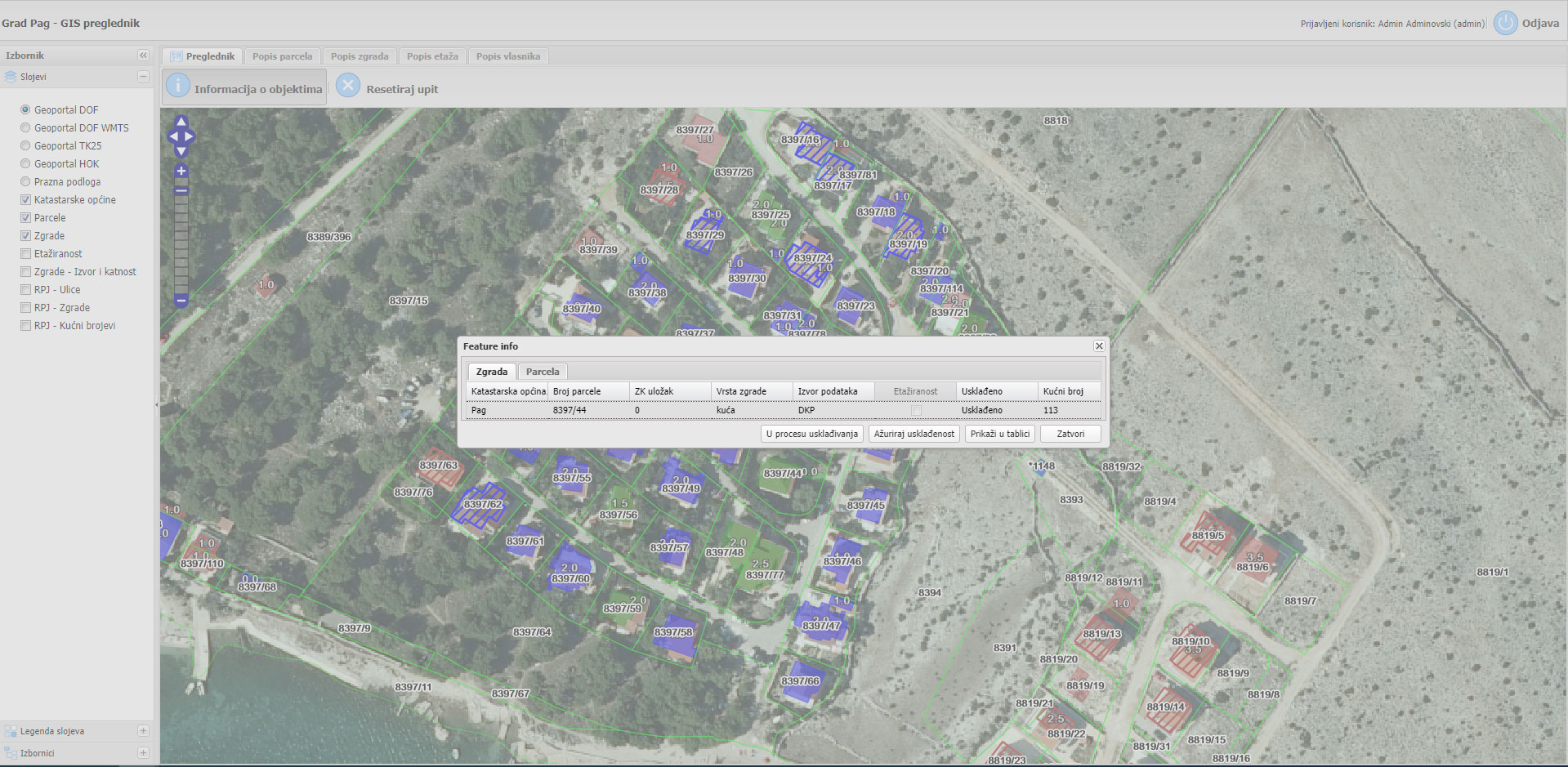
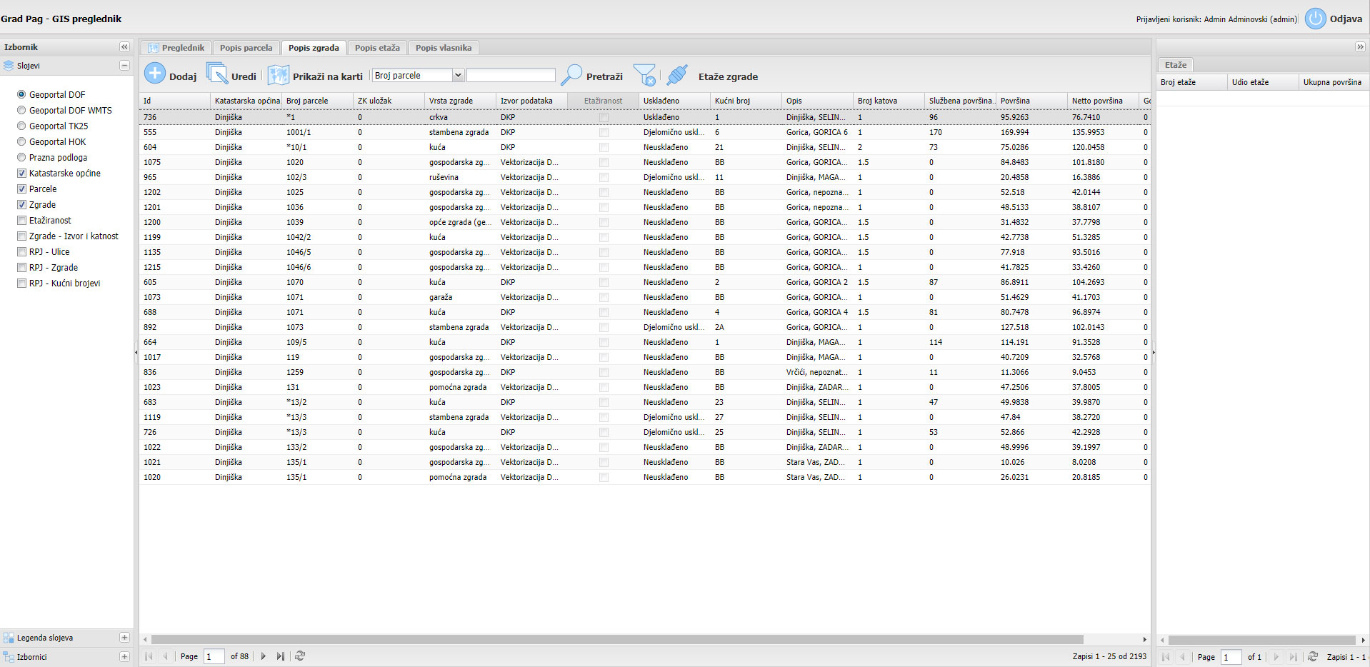
Client: City of Pag
Description: Database modelling. Development of the webGIS application by using ExtJS, OpenLayers, PHP, PostgreSQL+PostGIS, Geoserver
Duration: 2015
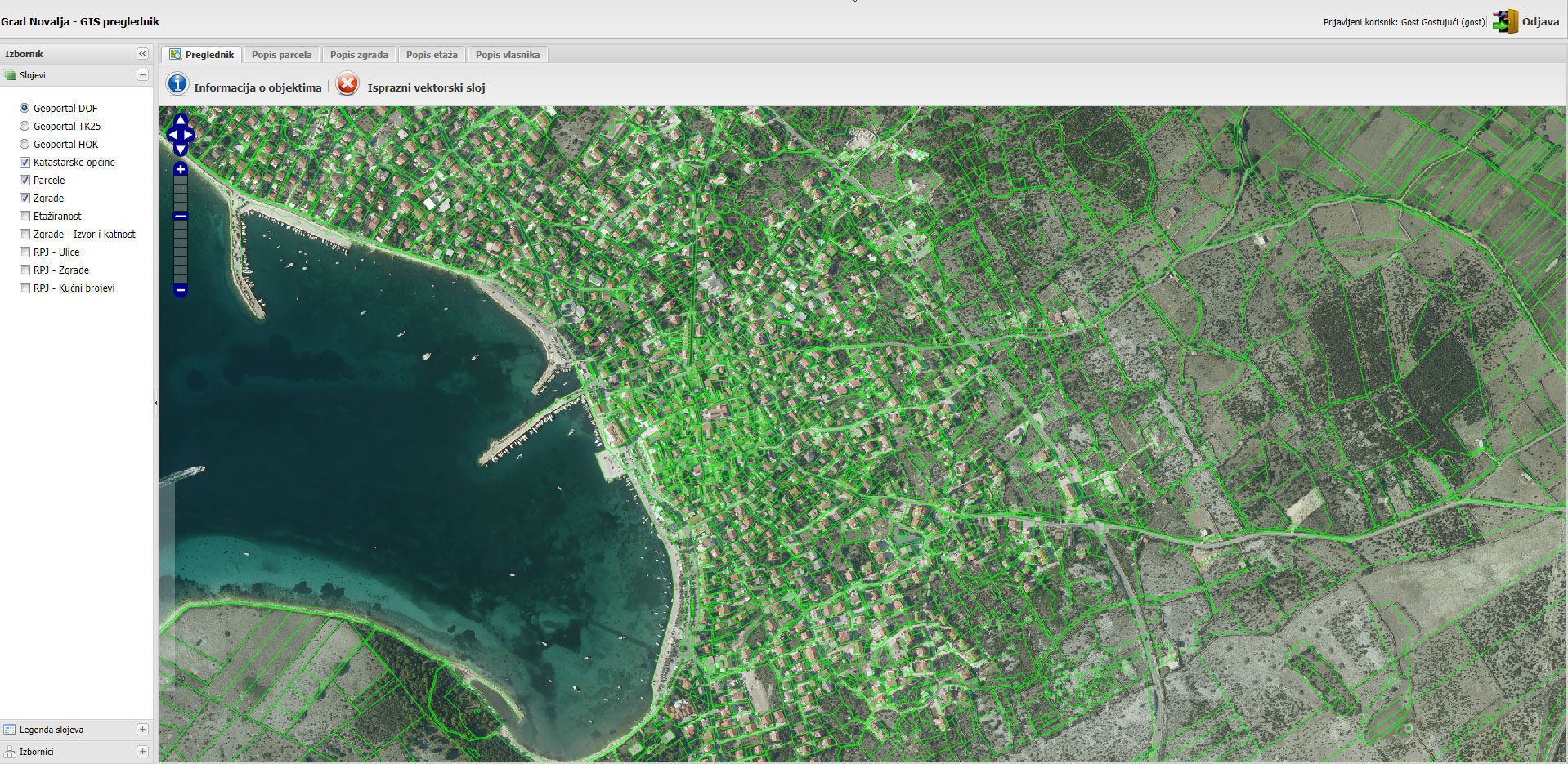
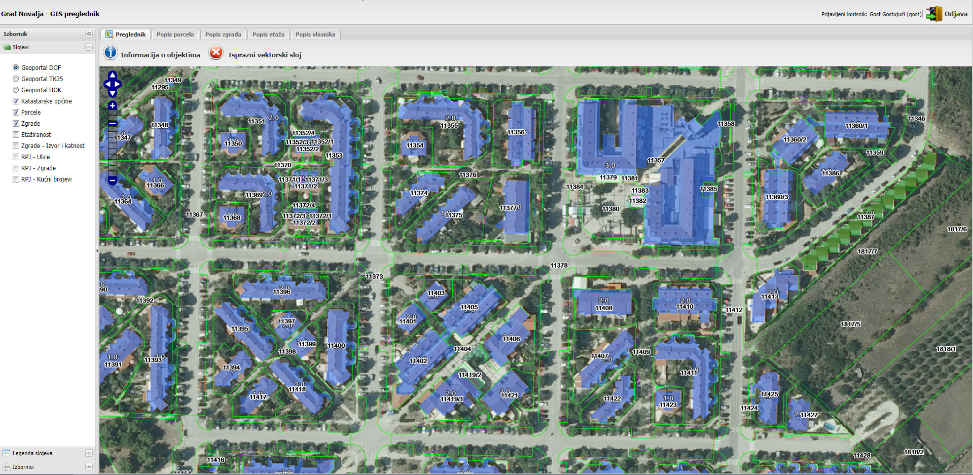
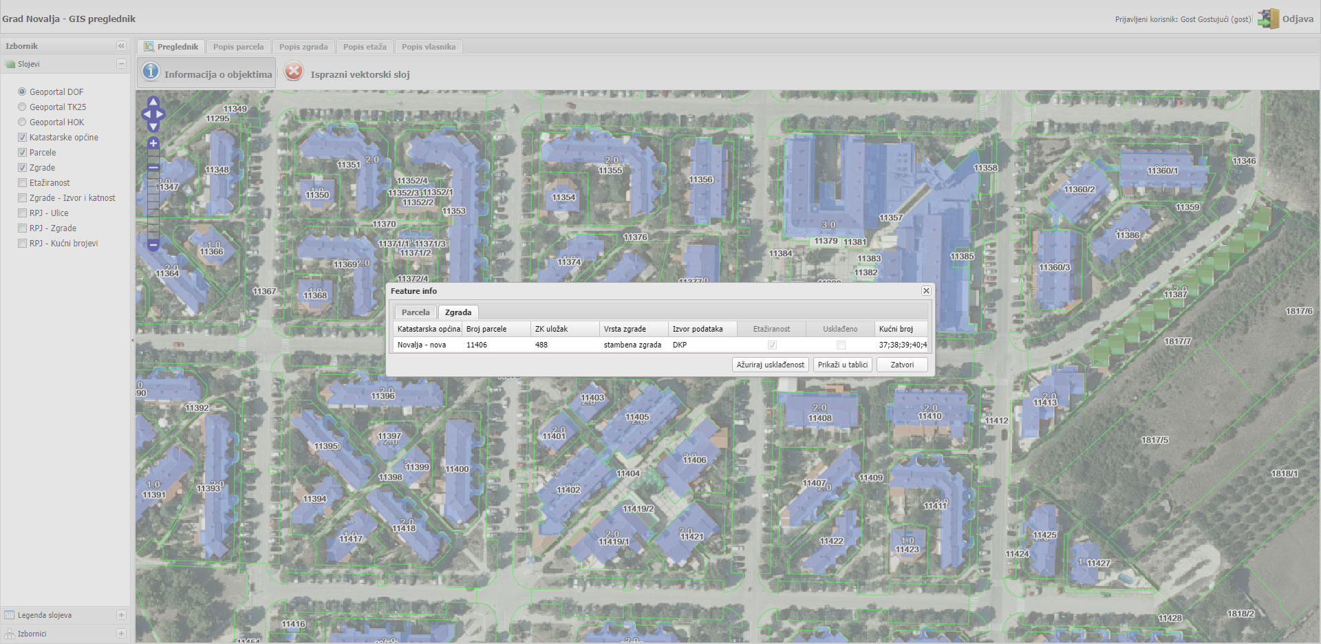
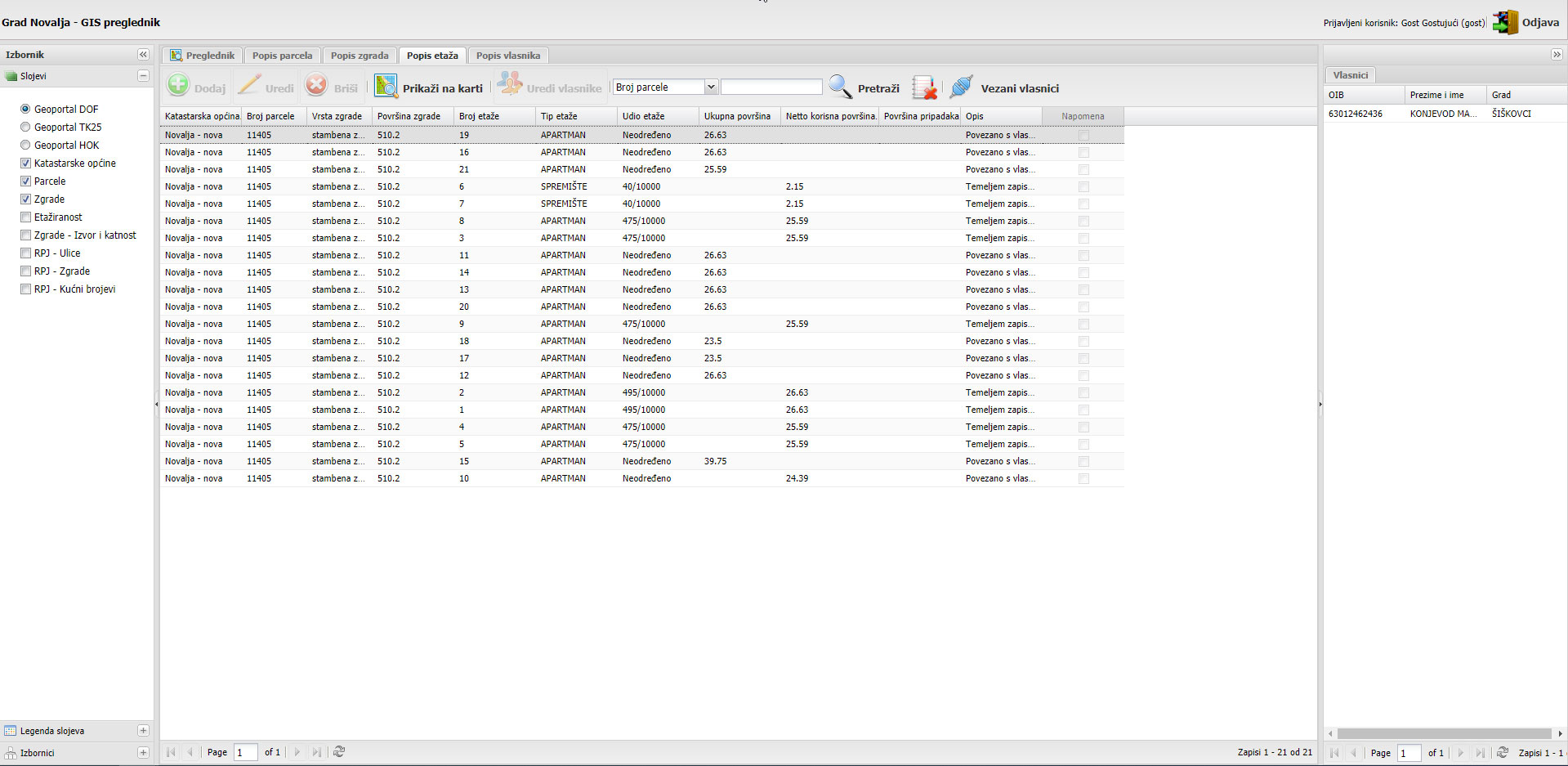
Client: City of Novalja
Description: Database modelling. Development of the webGIS application by using ExtJS, OpenLayers, PHP, PostgreSQL+PostGIS, Geoserver
Duration: 2014
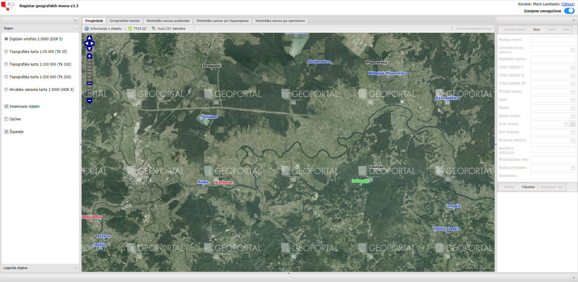
Client: State Geodetic Administration
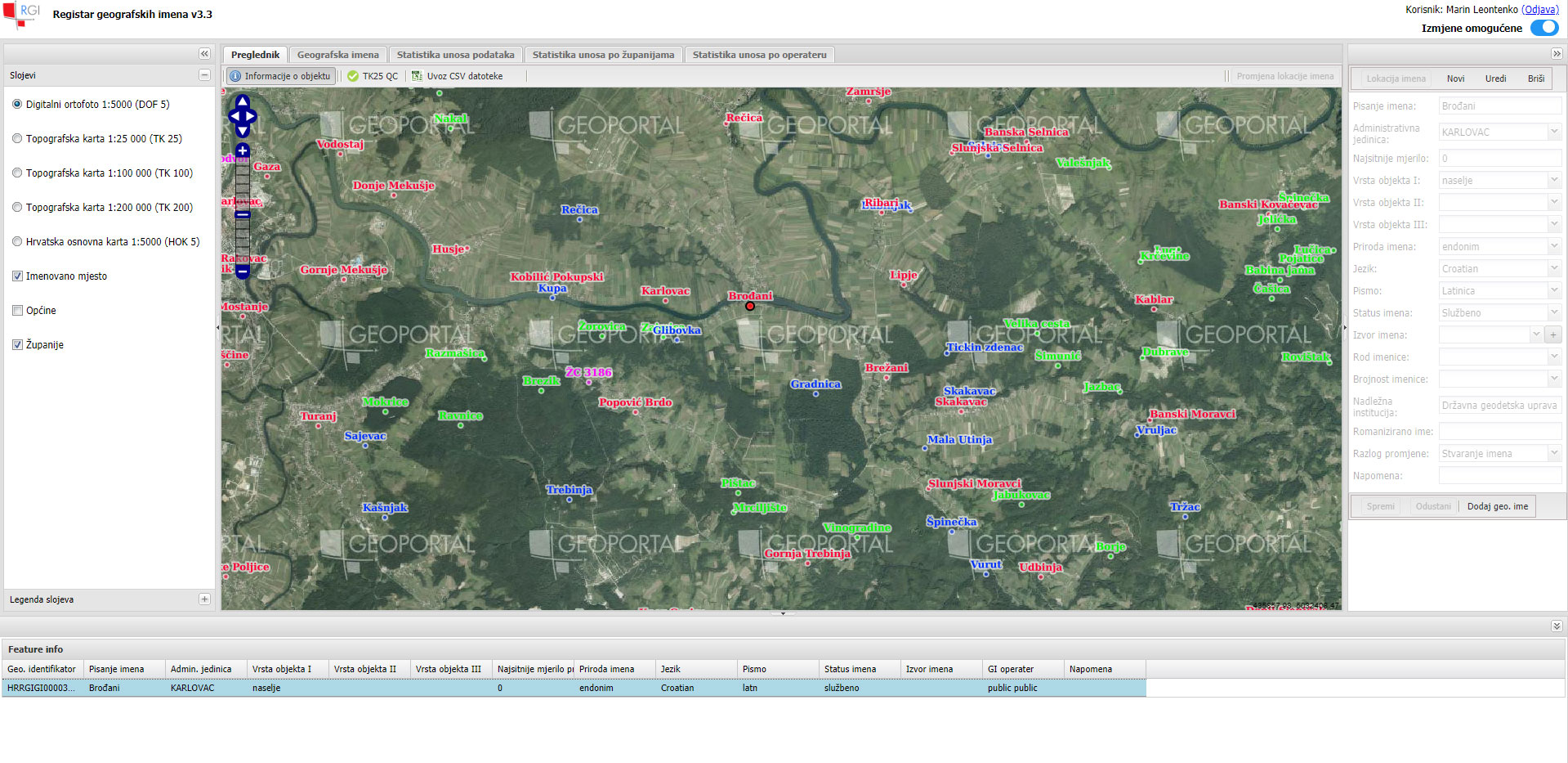
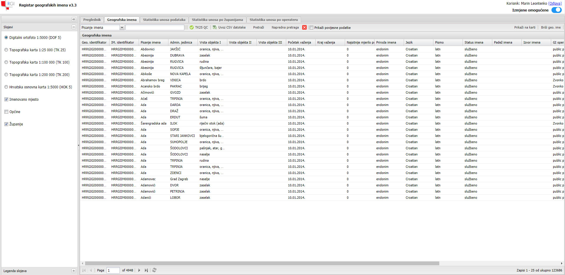
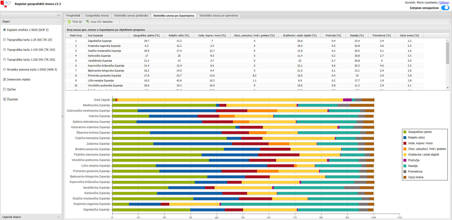
Description: Defining the new data model based on requirements of INSPIRE and relevant geographical names data products. Implementation of supporting database system in PostGIS RDBMS. Development of web based platform for management of geographical names. Platform was implemented with the use of GeoServer application server and ExtJS framework. Migration of existing geographical names to the new database model by using FME. Implementation of network services for viewing and downloading harmonized datasets according to the INSPIRE directive.
Duration: 2013
Let's stay connected:


